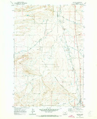
1970 Map of Buffalo
USGS Topo · Published 1973About this map
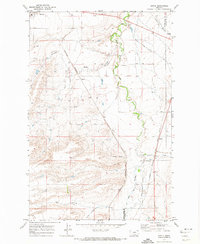
Buffalo and the surrounding high plains of Central Montana are defined here by a transition from traditional rail-corridor settlements to a landscape shaped by hydrology and early infrastructure. The map documents the convergence of two major rail systems: the Burlington Northern running through the heart of the area and the Chicago Milwaukee St Paul and Pacific navigating the eastern drainage. These tracks connect small hubs like Mc Clave and Garnell, which served as vital collection points for the region's agricultural output.
Find a feature on this map
20 named features on this map. Tap any name to fly to it.
Don’t see what you’re looking for? This feature index may not catch every label — zoom into the map to look around manually.
Map Details
Editions of this 1970 Buffalo Map
This is the sole edition of this map. No revisions or reprints were ever made.
Other maps of this area

1889 · Big Snowy Mountain
USGS Topo · 1:250,000

1893 · Big Snowy Mountain
USGS Topo · 1:250,000

1954 · Roundup
USGS Topo · 1:250,000

1958 · Roundup
USGS Topo · 1:250,000

1970 · Moore
USGS Topo · 1:24,000
1970 · Martin Coulee
USGS Topo · 1:24,000
1970 · Ackley Lake
USGS Topo · 1:24,000
1970 · Moore SW
USGS Topo · 1:24,000
1970 · Sipple
USGS Topo · 1:24,000
1986 · Mead Creek
USGS Topo · 1:24,000