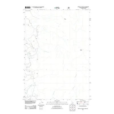
2011 Map of Buffalo Lake NE
USGS Topo · Published 2011About this map
Moose Creek Plateau and the Madison Plateau dominate this high-altitude landscape where the borders of Montana, Idaho, and Wyoming converge. The area is defined by its drainage networks, with North Fork Split Creek and the Middle Fork Split Creek carving through the western reaches, while Boundary Creek and Cascade Creek flow toward the south and east. The rugged topography is further shaped by Echo Canyon in the north-central portion of the quadrangle. Human activity is limited to a small network of access routes, including the Black Canyon Loop Rd and the Natl Forest Develop Road 410 Trl. These corridors suggest the area's primary use for forest management and backcountry recreation, preserved here in their early 21st-century configuration.
Find a feature on this map
10 named features on this map. Tap any name to fly to it.
Don’t see what you’re looking for? This feature index may not catch every label — zoom into the map to look around manually.
Map Details
Editions of this 2011 Buffalo Lake NE Map
This is the sole edition of this map. No revisions or reprints were ever made.
Other maps of this area

1885 · Gallatin
USGS Topo · 1:125,000

1885 · Gallatin
USGS Topo · 1:125,000

1886 · Shoshone
USGS Topo · 1:125,000

1888 · Shoshone
USGS Topo · 1:125,000

1895 · Shoshone
USGS Topo · 1:125,000

1901 · Shoshone
USGS Topo · 1:125,000

1901 · Gallatin
USGS Topo · 1:125,000

1908 · Gallatin
USGS Topo · 1:125,000

1908 · Shoshone
USGS Topo · 1:125,000

1911 · Shoshone
USGS Topo · 1:125,000