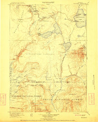
1911 Map of Shoshone
USGS Topo · Published 1911About this map
The geothermal wonders of Yellowstone National Park are documented here during the early twentieth century, showing a landscape defined by its thermal basins and early tourism infrastructure. The legendary Old Faithful geyser sits at the heart of the upper Geyser Basin alongside the Giantess Geyser and Grotto Geyser. Early park visitors would have recognized the Thumb Hotel on the shores of West Thumb, a key stop for travelers traversing the Continental Divide via Craig Pass.
Find a feature on this map
102 named features on this map. Tap any name to fly to it.
Don’t see what you’re looking for? This feature index may not catch every label — zoom into the map to look around manually.
Map Details
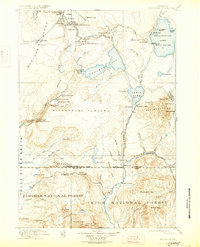
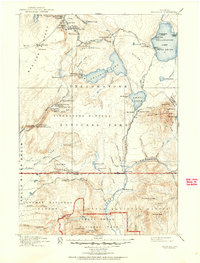
Editions of this 1911 Shoshone Map
3 editions found
Other maps of this area

1885 · Lake
USGS Topo · 1:125,000

1885 · Gallatin
USGS Topo · 1:125,000

1885 · Gallatin
USGS Topo · 1:125,000

1886 · Shoshone
USGS Topo · 1:125,000

1886 · Canyon
USGS Topo · 1:125,000

1888 · Shoshone
USGS Topo · 1:125,000

1895 · Shoshone
USGS Topo · 1:125,000

1895 · Canyon
USGS Topo · 1:125,000

1895 · Lake
USGS Topo · 1:125,000

1896 · Lake
USGS Topo · 1:125,000