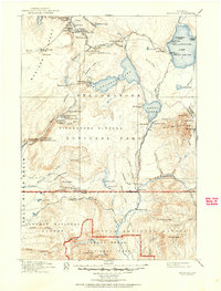
1911 Map of Shoshone
USGS Topo · Published 1951About this map
Upper Geyser Basin serves as the focal point of this 1910-era survey, capturing the early infrastructure of American conservation. The presence of the Old Faithful Inn and Old Faithful Lodge alongside the Old Faithful geyser itself illustrates the nascent stage of tourism at the turn of the century. Beyond the geysers, the map details a wilderness defined by thermal features like Jewel Geyser and Lone Star Geyser, and the complex hydrology of the Continental Divide between Shoshone Lake and Lewis Lake.
Find a feature on this map
118 named features on this map. Tap any name to fly to it.
Don’t see what you’re looking for? This feature index may not catch every label — zoom into the map to look around manually.
Map Details
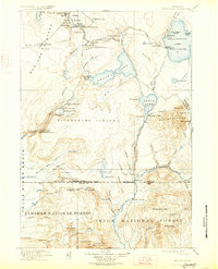
Editions of this 1911 Shoshone Map
3 editions found

Other maps of this area

1885 · Lake
USGS Topo · 1:125,000

1885 · Gallatin
USGS Topo · 1:125,000

1885 · Gallatin
USGS Topo · 1:125,000

1886 · Shoshone
USGS Topo · 1:125,000

1886 · Canyon
USGS Topo · 1:125,000

1888 · Shoshone
USGS Topo · 1:125,000

1895 · Shoshone
USGS Topo · 1:125,000

1895 · Canyon
USGS Topo · 1:125,000

1895 · Lake
USGS Topo · 1:125,000

1896 · Lake
USGS Topo · 1:125,000