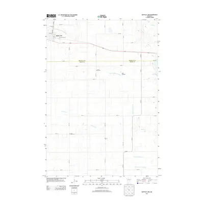
2013 Map of Buffalo Lake
USGS Topo · Published 2013About this map
Buffalo Lake serves as the primary hub of this 2013 survey, where the established town grid meets the agricultural expanse of the Minnesota prairie. The landscape is defined by an intricate network of drainage systems, including Judicial Ditch Number Fifteen and County Ditch Number Ten, which support the surrounding farmland. Genealogists will find a high density of burial sites across the township, from the Evangelical Cem near the town center to more rural locations like Knopke Brown Cem and United Brethren Cem. Water management is a central theme of the terrain, visible in the conversion of wetlands like Buck Lakebed and the winding course of High Island Cr. The survey also marks the boundary between Renville Co and Sibley Co, bisecting a region tied together by the prominent corridor of Us-212.
Find a feature on this map
37 named features on this map. Tap any name to fly to it.
Don’t see what you’re looking for? This feature index may not catch every label — zoom into the map to look around manually.
Map Details
Editions of this 2013 Buffalo Lake Map
This is the sole edition of this map. No revisions or reprints were ever made.
Other maps of this area

1953 · New Ulm
USGS Topo · 1:250,000

1957 · New Ulm
USGS Topo · 1:250,000

1958 · New Ulm
USGS Topo · 1:250,000

1958 · Winthrop
USGS Topo · 1:62,500

1958 · Hutchinson
USGS Topo · 1:62,500

1964 · Fairfax
USGS Topo · 1:24,000

1964 · Buffalo Lake
USGS Topo · 1:24,000

1964 · Hector
USGS Topo · 1:24,000

1964 · Gibbon
USGS Topo · 1:24,000

1967 · New Ulm
USGS Topo · 1:250,000