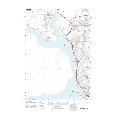
2013 Map of Buffalo NW
USGS Topo · Published 2013About this map
The Niagara River serves as the dominant geographical feature here, separating the suburban developments of Grand Island from the dense urban grid of Buffalo. On the western bank, the settlements of Grandyke Village, Ferry Village, and Oakfield are situated amidst the expansive Beaver Island State Park, where the Grand Island Range Lights once guided river traffic. The river itself is punctuated by several landmasses including Squaw Island, Strawberry Island, and Pirates Island, illustrating the complex hydrology at the entrance to Lake Erie.
Find a feature on this map
33 named features on this map. Tap any name to fly to it.
Don’t see what you’re looking for? This feature index may not catch every label — zoom into the map to look around manually.
Map Details
Editions of this 2013 Buffalo NW Map
This is the sole edition of this map. No revisions or reprints were ever made.
Other maps of this area

1894 · Buffalo
USGS Topo · 1:62,500

1894 · Niagara Falls
USGS Topo · 1:62,500

1896 · Niagara Falls
USGS Topo · 1:62,500

1897 · Tonawanda
USGS Topo · 1:62,500

1899 · Niagara
USGS Topo · 1:125,000

1900 · Tonawanda
USGS Topo · 1:62,500

1900 · Niagara Falls
USGS Topo · 1:62,500

1901 · Buffalo
USGS Topo · 1:62,500

1901 · Niagara Falls
USGS Topo · 1:62,500

1901 · Tonawanda
USGS Topo · 1:62,500