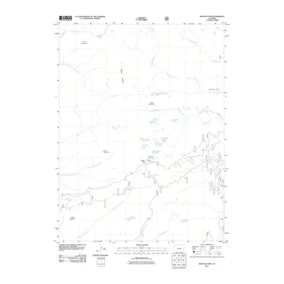
2011 Map of Buffalo Pass
USGS Topo · Published 2011About this map
Buffalo Pass serves as a critical high-elevation crossing through the Park Range, surrounded by a dense cluster of alpine lakes and headwater streams. This 2011 survey illustrates a landscape dominated by water and topography, where small bodies like Lake Dinosaur, Martha Lake, and Jonah Lake sit nestled among peaks including Soda Mountain and Buffalo Mountain. The area is a vital watershed, giving rise to numerous drainages such as Soda Creek, Chedsey Creek, and the various forks of North Fork Fish Creek and Middle Fork Fish Creek. Recreational infrastructure is concentrated near the pass at the Summit Lake Campground, while further north, the terrain transitions into the open spaces of Newcomb Park and Thief Park. The network of forest roads, including FS RD 310 and Co RD 24, traces the winding paths required to navigate this portion of the Continental Divide.
Find a feature on this map
41 named features on this map. Tap any name to fly to it.
Don’t see what you’re looking for? This feature index may not catch every label — zoom into the map to look around manually.
Map Details
Editions of this 2011 Buffalo Pass Map
This is the sole edition of this map. No revisions or reprints were ever made.
Other maps of this area

1911 · Hahns Peak
USGS Topo · 1:125,000

1913 · Hahns Peak
USGS Topo · 1:125,000

1954 · Craig
USGS Topo · 1:250,000

1955 · Buffalo Pass
USGS Topo · 1:24,000

1955 · Pitchpine Mountain
USGS Topo · 1:24,000

1955 · Mount Ethel
USGS Topo · 1:24,000

1955 · Teal Lake
USGS Topo · 1:24,000

1955 · Mount Ethel
USGS Topo · 1:62,500

1956 · Rabbit Ears Peak
USGS Topo · 1:24,000

1956 · Storm Mountain
USGS Topo · 1:24,000