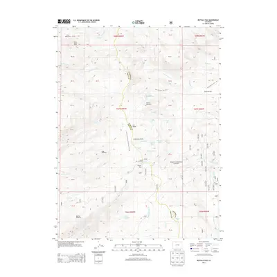
2013 Map of Buffalo Pass
USGS Topo · Published 2013About this map
Buffalo Pass serves as a critical high-altitude crossing of the Park Range in this section of the Routt National Forest, marking the boundary between Jackson and Routt counties. The landscape is defined by the Continental Divide, where alpine waters flow toward either the Yampa or North Platte basins. A dense network of glacial lakes, including Summit Lake, Lake Albert, and Lake Dinosaur, dot the high-country basins surrounding Soda Mountain and Buffalo Mountain. Recreation and trail infrastructure are prominent, with the Continental Divide National Scenic Trail and the Newcomb Creek Trail providing access to remote areas like Horse Thief Park. The presence of the Summit Lake Campground near the pass highlights the area's role as a destination for outdoor transit and exploration in the early twenty-first century.
Find a feature on this map
58 named features on this map. Tap any name to fly to it.
Don’t see what you’re looking for? This feature index may not catch every label — zoom into the map to look around manually.
Map Details
Editions of this 2013 Buffalo Pass Map
This is the sole edition of this map. No revisions or reprints were ever made.
Other maps of this area

1911 · Hahns Peak
USGS Topo · 1:125,000

1913 · Hahns Peak
USGS Topo · 1:125,000

1954 · Craig
USGS Topo · 1:250,000

1955 · Buffalo Pass
USGS Topo · 1:24,000

1955 · Pitchpine Mountain
USGS Topo · 1:24,000

1955 · Mount Ethel
USGS Topo · 1:24,000

1955 · Teal Lake
USGS Topo · 1:24,000

1955 · Mount Ethel
USGS Topo · 1:62,500

1956 · Rabbit Ears Peak
USGS Topo · 1:24,000

1956 · Storm Mountain
USGS Topo · 1:24,000