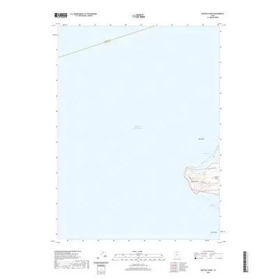
2020 Map of Buffalo Point
USGS Topo · Published 2020About this map
Antelope Island rises from the southeastern waters of the Great Salt Lake in this survey of the Buffalo Point quadrangle. The map focuses on the island's northwestern projection, where the terrain climbs toward the high ground of Buffalo Point and the namesake Buffalo Spring. The shoreline is defined by protected inlets like Bridger Bay and White Rock Bay, which are separated by prominent landforms. The Weber and Davis County line bisects the open water to the north, while small outcrops like Egg Island and White Rock stand isolated offshore. Access to this portion of the island is facilitated by the Antelope Island Rd, which connects to the winding Lake Side route along the western coast.
Find a feature on this map
12 named features on this map. Tap any name to fly to it.
Don’t see what you’re looking for? This feature index may not catch every label — zoom into the map to look around manually.
Map Details
Editions of this 2020 Buffalo Point Map
This is the sole edition of this map. No revisions or reprints were ever made.
Other maps of this area

1885 · Tooele Valley
USGS Topo · 1:250,000

1953 · Tooele
USGS Topo · 1:250,000

1954 · Antelope Island
USGS Topo · 1:24,000

1954 · Antelope Island North
USGS Topo · 1:24,000

1954 · Brigham City
USGS Topo · 1:250,000

1955 · Ogden Bay
USGS Topo · 1:24,000

1955 · Fremont Island
USGS Topo · 1:24,000

1955 · Tooele
USGS Topo · 1:250,000

1958 · Brigham City
USGS Topo · 1:250,000

1962 · Brigham City
USGS Topo · 1:250,000