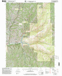
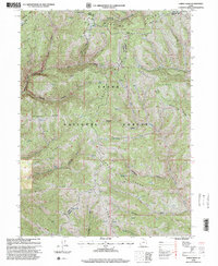
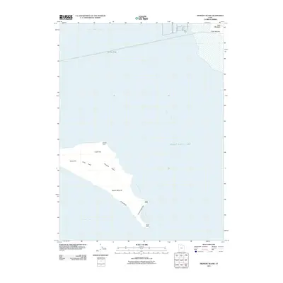
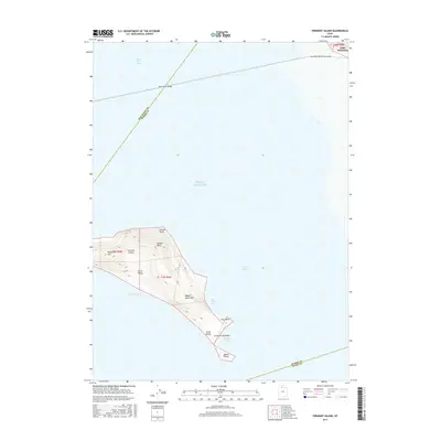
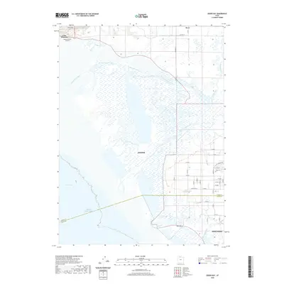
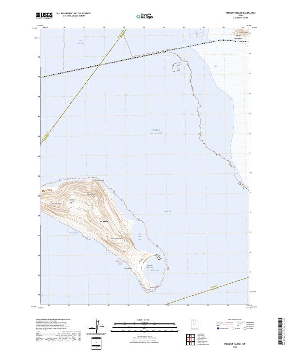
1955 Map of Fremont Island
USGS Topo · Published 1956About this map
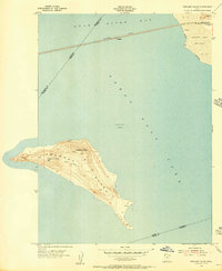
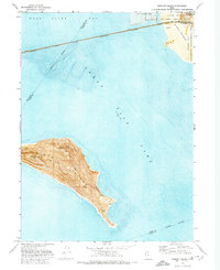
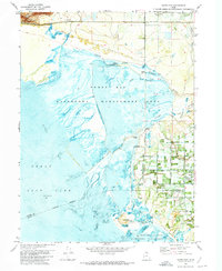
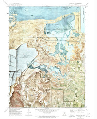
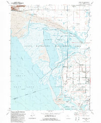
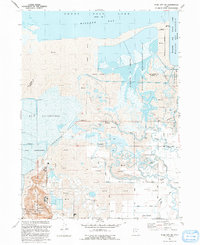
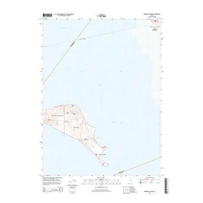
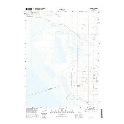
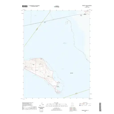
Fremont Island dominates this mid-century survey, rising from the waters of the Great Salt Lake between the boundaries of Box Elder, Weber, and Davis counties. The island's topography is defined by high points like Beacon Hill and Castle Rock, with the southern reaches showing evidence of past habitation through markers for Ruins and Graves. To the north, the Southern Pacific railroad cuts directly across the Bear River Bay on a long causeway, passing the isolated station point at Bagley. The shoreline near Little Mountain reveals the saline landscape of the Salt Flat and the protected marshes of the Ogden Bay Refuge. This survey captures the island in a period of relative isolation, providing a detailed record of its interior features like Circle Valley and various springs before more modern alterations to the lake's hydrology.
Find a feature on this map
17 named features on this map. Tap any name to fly to it.
Don’t see what you’re looking for? This feature index may not catch every label — zoom into the map to look around manually.
Map Details
Editions of this 1955 Fremont Island Map
This is the sole edition of this map. No revisions or reprints were ever made.
Historical Maps of Hooper Through Time
48 maps found
1955 Fremont Island
Weber County, UT
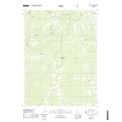
1955 Ogden Bay
Weber County, UT
1955 Plain City SW
Weber County, UT
1964 Browns Hole
Weber County, UT
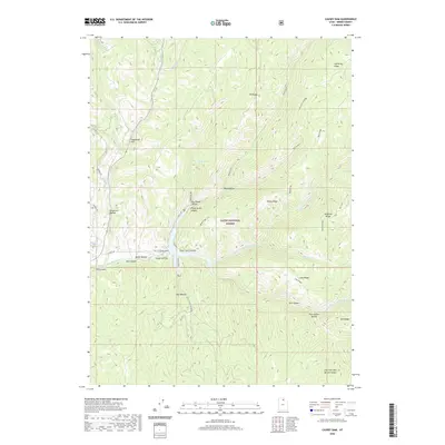
1964 Causey Dam
Weber County, UT
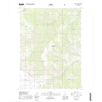
1968 Horse Ridge
Weber County, UT
1972 Fremont Island
Weber County, UT
1972 Ogden Bay
Weber County, UT
1972 Plain City SW
Weber County, UT
1991 Browns Hole
Weber County, UT
1991 Causey Dam
Weber County, UT
1991 Fremont Island
Weber County, UT
1991 Horse Ridge
Weber County, UT
1991 Ogden Bay
Weber County, UT
1991 Plain City SW
Weber County, UT
1998 Browns Hole
Weber County, UT
1998 Causey Dam
Weber County, UT
1998 Horse Ridge
Weber County, UT
2011 Browns Hole
Weber County, UT
2011 Causey Dam
Weber County, UT
2011 Fremont Island
Weber County, UT
2011 Horse Ridge
Weber County, UT
2011 Ogden Bay
Weber County, UT
2011 Plain City SW
Weber County, UT
2014 Browns Hole
Weber County, UT
2014 Causey Dam
Weber County, UT
2014 Fremont Island
Weber County, UT
2014 Horse Ridge
Weber County, UT
2014 Ogden Bay
Weber County, UT
2014 Plain City SW
Weber County, UT
2017 Browns Hole
Weber County, UT
2017 Causey Dam
Weber County, UT
2017 Fremont Island
Weber County, UT
2017 Horse Ridge
Weber County, UT
2017 Ogden Bay
Weber County, UT
2017 Plain City SW
Weber County, UT
2020 Browns Hole
Weber County, UT
2020 Causey Dam
Weber County, UT
2020 Fremont Island
Weber County, UT
2020 Horse Ridge
Weber County, UT
2020 Ogden Bay
Weber County, UT
2020 Plain City SW
Weber County, UT
2023 Browns Hole
Weber County, UT
2023 Causey Dam
Weber County, UT
2023 Fremont Island
Weber County, UT
2023 Horse Ridge
Weber County, UT
2023 Ogden Bay
Weber County, UT
2023 Plain City SW
Weber County, UT