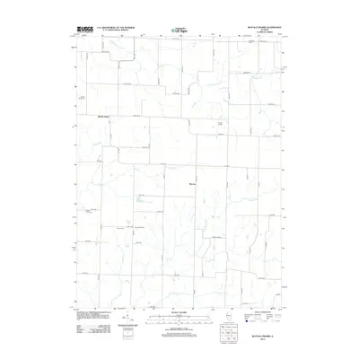
2012 Map of Buffalo Prairie
USGS Topo · Published 2012About this map
Buffalo Prairie and the smaller settlement of Marston anchor this Rock Island County landscape, where agriculture and hydrology define the local geography. The area is intersected by a complex network of waterways, including the winding Copperas Cr in the north and the southern drainage patterns of Camp Cr and Little Camp Cr. For those researching family history in the region, several burial grounds are well-documented, such as Edgington Cem, Buffalo Prairie Cem, and Duncan Cem. The map reveals a highly structured grid of rural roads, such as 170th Ave and 135th Ave, which connect isolated landmarks like Duncan Town Hall and the private Goode Airport. The presence of the Illinois Slough and Lake Nelson further illustrates the low-lying, water-rich character of this section of the Illinois countryside.
Find a feature on this map
35 named features on this map. Tap any name to fly to it.
Don’t see what you’re looking for? This feature index may not catch every label — zoom into the map to look around manually.
Map Details
Editions of this 2012 Buffalo Prairie Map
This is the sole edition of this map. No revisions or reprints were ever made.
Other maps of this area

1912 · Milan
USGS Topo · 1:62,500

1916 · Edgington
USGS Topo · 1:62,500

1923 · Alexis
USGS Topo · 1:62,500

1925 · Alexis
USGS Topo · 1:62,500

1935 · Keithsburg
USGS Topo · 1:48,000

1938 · Edgington
USGS Topo · 1:62,500

1941 · Keithsburg
USGS Topo · 1:62,500

1944 · Milan
USGS Topo · 1:62,500

1953 · Buffalo Prairie
USGS Topo · 1:24,000
1953 · Illinois City
USGS Topo · 1:24,000