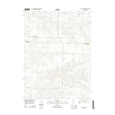
2015 Map of Buffalo Prairie
USGS Topo · Published 2015About this map
Buffalo Prairie serves as the focal point for this rural Illinois landscape, situated at the junction of 183rd Ave W and 173rd Ave W. The terrain is defined by a dense network of watercourses, including Copperas Cr in the north and the winding Illinois Slough to the south. Historically significant sites for genealogists are scattered across the quadrangle, notably Edgington Cem near the northern boundary and Buffalo Prairie Cem to the southwest. The map also delineates the jurisdictional transition along 180th Ave, where the Rock Island and Mercer County line divides the agricultural holdings. The small settlement of Marston and landmarks like Lake Nelson provide further evidence of the area's distributed community structure, linked by a strict grid of section roads such as Way Out Farm Rd and 160th Ave.
Find a feature on this map
30 named features on this map. Tap any name to fly to it.
Don’t see what you’re looking for? This feature index may not catch every label — zoom into the map to look around manually.
Map Details
Editions of this 2015 Buffalo Prairie Map
This is the sole edition of this map. No revisions or reprints were ever made.
Other maps of this area

1912 · Milan
USGS Topo · 1:62,500

1916 · Edgington
USGS Topo · 1:62,500

1923 · Alexis
USGS Topo · 1:62,500

1925 · Alexis
USGS Topo · 1:62,500

1935 · Keithsburg
USGS Topo · 1:48,000

1938 · Edgington
USGS Topo · 1:62,500

1941 · Keithsburg
USGS Topo · 1:62,500

1944 · Milan
USGS Topo · 1:62,500

1953 · Buffalo Prairie
USGS Topo · 1:24,000
1953 · Illinois City
USGS Topo · 1:24,000