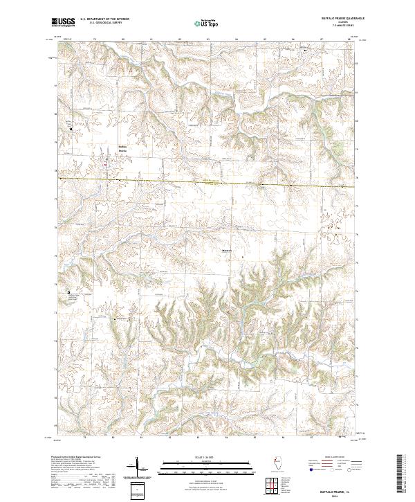
2024 Map of Buffalo Prairie
USGS Topo · Published 2024About this map
Buffalo Prairie and the surrounding farmland of western Illinois are captured here in the early 21st century, revealing a landscape defined by deep creek valleys and high ridge-top roads. The terrain is bifurcated by the Rock Island and Mercer county line, where the upland prairie breaks into the drainage basins of Copperas Creek and Eliza Creek. Genealogists will find significant value in the concentration of local burial sites, including the Buffalo Prairie Cem, Edgington Cem, Duncan Cem, and the historically distinct Buffalo Prairie Latter Day Saints Cem. The small settlement of Marston serves as a local landmark among a grid of rural routes like County Highway 11 and Wayout Farm Road. To the southeast, the water network becomes more complex with Illinois Slough, Camp Creek, and Little Camp Creek carving through the agricultural landscape.
Find a feature on this map
37 named features on this map. Tap any name to fly to it.
Don’t see what you’re looking for? This feature index may not catch every label — zoom into the map to look around manually.
Map Details
Editions of this 2024 Buffalo Prairie Map
This is the sole edition of this map. No revisions or reprints were ever made.
Other maps of this area

1912 · Milan
USGS Topo · 1:62,500

1916 · Edgington
USGS Topo · 1:62,500

1923 · Alexis
USGS Topo · 1:62,500

1925 · Alexis
USGS Topo · 1:62,500

1935 · Keithsburg
USGS Topo · 1:48,000

1938 · Edgington
USGS Topo · 1:62,500

1941 · Keithsburg
USGS Topo · 1:62,500

1944 · Milan
USGS Topo · 1:62,500

1953 · Buffalo Prairie
USGS Topo · 1:24,000
1953 · Illinois City
USGS Topo · 1:24,000