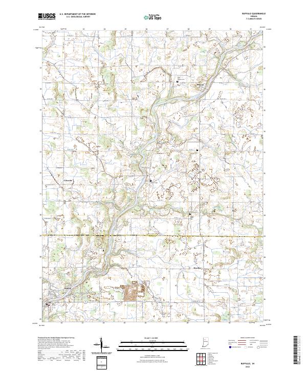
2022 Map of Buffalo
USGS Topo · Published 2022About this map
The Tippecanoe River meanders through this portion of Northwest Indiana, defining the geography of small settlements and the complex drainage networks of the surrounding farmland. In the north, the village of Pulaski sits at a prominent bend in the river, while Buffalo occupies the southern reach near the edge of White County. The landscape is intensely managed for agriculture, evidenced by an intricate system of man-made waterways like Budd Fisher Ditch, Harpster Ditch, and Ackerman Ditch that channel water toward the primary river valley. Genealogists will find several rural burial sites documented, including Hoover Cem and Indian Creek Cem, which mark early community centers alongside smaller crossroads like Headlee and Lakeside. The map illustrates the persistent intersection of the region's hydraulic engineering and its historical settlement patterns.
Find a feature on this map
67 named features on this map. Tap any name to fly to it.
Don’t see what you’re looking for? This feature index may not catch every label — zoom into the map to look around manually.
Map Details
Editions of this 2022 Buffalo Map
This is the sole edition of this map. No revisions or reprints were ever made.
Other maps of this area

1953 · Chicago
USGS Topo · 1:250,000

1953 · Danville
USGS Topo · 1:250,000

1955 · Danville
USGS Topo · 1:250,000

1956 · Danville
USGS Topo · 1:250,000

1957 · Chicago
USGS Topo · 1:250,000

1962 · Buffalo
USGS Topo · 1:24,000

1962 · Monon NE
USGS Topo · 1:24,000

1962 · Winamac
USGS Topo · 1:24,000

1962 · Star City
USGS Topo · 1:24,000

1962 · Burnettsville
USGS Topo · 1:24,000