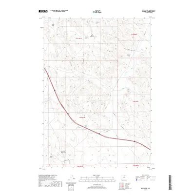
2017 Map of Buffalo SE
USGS Topo · Published 2017About this map
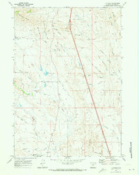
Petrified Forest Site and a complex network of ephemeral drainages characterize this high plains landscape in southern Johnson County. The terrain is defined by deeply etched erosion patterns, most notably the converging channels of Center Draw, Healy Draw, and McNeese Draw as they move toward the intermittent flow of Dry Cr. This area reveals a rural landscape focused on ranching infrastructure and mineral access, indicated by named routes like Camino Mines Rd, Barn RD, and Red Hills Rd. The presence of the Redmar Ditch in the northwest corner highlights the importance of water management in this arid environment, while the proximity of various draws such as Hakert Draw and Evans Draw suggests a topography shaped by seasonal runoff across the expansive rangeland.
Find a feature on this map
29 named features on this map. Tap any name to fly to it.
Don’t see what you’re looking for? This feature index may not catch every label — zoom into the map to look around manually.
Map Details
Editions of this 2017 Buffalo SE Map
This is the sole edition of this map. No revisions or reprints were ever made.
Other maps of this area

1900 · Fort McKinney
USGS Topo · 1:125,000

1903 · Fort McKinney
USGS Topo · 1:125,000

1955 · Sheridan
USGS Topo · 1:250,000

1958 · Sheridan
USGS Topo · 1:250,000

1962 · Sheridan
USGS Topo · 1:250,000
1970 · Buffalo
USGS Topo · 1:24,000

1970 · Buffalo NE
USGS Topo · 1:24,000
1970 · Buffalo SE
USGS Topo · 1:24,000
1970 · Lake De Smet East
USGS Topo · 1:24,000
1970 · T A Ranch
USGS Topo · 1:24,000