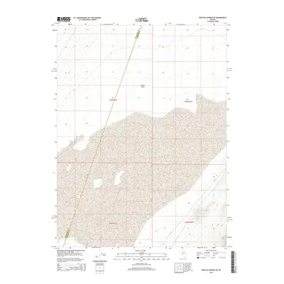
2014 Map of Buffalo Springs NE
USGS Topo · Published 2014About this map
Buffalo Valley defines the core of this landscape in Nevada's high desert, where the vast, seasonally variable terrain of Mud Lake serves as a central landmark. The map depicts a predominantly open, arid expanse where the county line between Pershing and Lander counties strikes a diagonal through the western half of the quadrangle. This 2014 survey records the presence of Cr-121, a primary local connector providing access through the southern and eastern reaches of the valley. The map is primarily characterized by its Public Land Survey System grid, with section lines and townships such as t30n r41e and t29n r42e providing the structural framework for this remote territory. The lack of permanent structures emphasizes the environmental character of the basin, dominated by the drainage patterns and playa features typical of the region.
Find a feature on this map
8 named features on this map. Tap any name to fly to it.
Don’t see what you’re looking for? This feature index may not catch every label — zoom into the map to look around manually.
Map Details
Editions of this 2014 Buffalo Springs NE Map
This is the sole edition of this map. No revisions or reprints were ever made.
Other maps of this area

1932 · Sonoma Range
USGS Topo · 1:250,000

1939 · Sonoma Range
USGS Topo · 1:250,000

1940 · Antler Peak
USGS Topo · 1:62,500

1943 · Antler Peak
USGS Topo · 1:62,500

1955 · Winnemucca
USGS Topo · 1:250,000

1958 · Winnemucca
USGS Topo · 1:250,000

1961 · McCoy
USGS Topo · 1:62,500

1962 · Winnemucca
USGS Topo · 1:250,000

1962 · Buffalo Springs
USGS Topo · 1:62,500
1965 · Cherry Creek SE
USGS Topo · 1:24,000