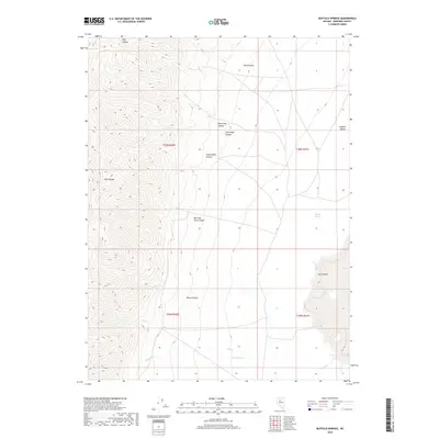
2018 Map of Buffalo Springs
USGS Topo · Published 2018About this map
Tobin Range peaks dominate the western half of this Pershing County landscape, where steep slopes descend sharply into the broad expanse of Buffalo Valley to the east. This transition from high mountain terrain to basin floor is defined by a series of drainage systems, most notably Morning View Canyon, Frank Helen Canyon, and Wood Canyon. These canyons served as vital corridors for water and movement in a high-desert environment, channeling runoff from the peaks toward the valley floor.
Find a feature on this map
18 named features on this map. Tap any name to fly to it.
Don’t see what you’re looking for? This feature index may not catch every label — zoom into the map to look around manually.
Map Details
Editions of this 2018 Buffalo Springs Map
This is the sole edition of this map. No revisions or reprints were ever made.
Other maps of this area

1932 · Sonoma Range
USGS Topo · 1:250,000

1939 · Sonoma Range
USGS Topo · 1:250,000

1955 · Winnemucca
USGS Topo · 1:250,000

1958 · Winnemucca
USGS Topo · 1:250,000

1961 · Mt. Tobin
USGS Topo · 1:62,500

1961 · Leach Hot Springs
USGS Topo · 1:62,500

1962 · Winnemucca
USGS Topo · 1:250,000

1962 · Buffalo Springs
USGS Topo · 1:62,500
1965 · Cherry Creek SE
USGS Topo · 1:24,000
1965 · China Mountain
USGS Topo · 1:24,000