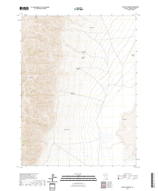
2021 Map of Buffalo Springs
USGS Topo · Published 2021About this map
The Tobin Range dominates this corner of Nevada, where steep elevation shifts define the western edge of the Buffalo Valley. This high-desert landscape is marked by a series of narrow drainage systems, including the namesake Buffalo Springs and several seasonal watercourses such as Big Cr and N Indian Cr. The alignment of these canyons, from Morning View Canyon to Frank Helen Canyon, suggests a terrain shaped by significant geological faulting and water runoff patterns common to the Great Basin. This 2021 update from the U.S. Geological Survey provides an accurate view of the contemporary hydrology and public land survey system lines that delineate these Pershing County hills and basin floors.
Find a feature on this map
18 named features on this map. Tap any name to fly to it.
Don’t see what you’re looking for? This feature index may not catch every label — zoom into the map to look around manually.
Map Details
Editions of this 2021 Buffalo Springs Map
This is the sole edition of this map. No revisions or reprints were ever made.
Other maps of this area

1932 · Sonoma Range
USGS Topo · 1:250,000

1939 · Sonoma Range
USGS Topo · 1:250,000

1955 · Winnemucca
USGS Topo · 1:250,000

1958 · Winnemucca
USGS Topo · 1:250,000

1961 · Mt. Tobin
USGS Topo · 1:62,500

1961 · Leach Hot Springs
USGS Topo · 1:62,500

1962 · Winnemucca
USGS Topo · 1:250,000

1962 · Buffalo Springs
USGS Topo · 1:62,500
1965 · Cherry Creek SE
USGS Topo · 1:24,000
1965 · China Mountain
USGS Topo · 1:24,000