
1973 Map of Buffalo Springs Ranch NE
USGS Topo · Published 1976About this map
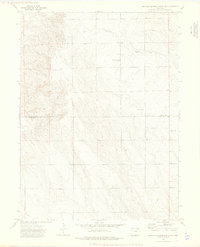
Logan County and Washington County meet in this high plains landscape defined by agricultural infrastructure and communication hubs in the early 1970s. The northern portion of the map is punctuated by the Kelly Community Center, a local gathering point for the surrounding rural homesteads. The terrain is marked by the meandering path of Rock Creek, which drains the undulating topography of this portion of the Colorado plains. Extensive utility and communication networks are evident throughout the area, including a prominent Pipeline crossing the southern boundary and multiple signal installations such as the Radio Towers and a specific Radio Facility. Local industry is represented by scattered Gravel Pit operations, supporting the road network of this sparsely populated ranching territory during a period of steady utility expansion.
Find a feature on this map
8 named features on this map. Tap any name to fly to it.
Don’t see what you’re looking for? This feature index may not catch every label — zoom into the map to look around manually.
Map Details
Editions of this 1973 Buffalo Springs Ranch NE Map
3 editions found
Other maps of this area

1951 · Reiradon Hill
USGS Topo · 1:24,000

1951 · Sterling South
USGS Topo · 1:24,000

1954 · Sterling
USGS Topo · 1:250,000

1958 · Sterling
USGS Topo · 1:250,000

1972 · Glacken Hill
USGS Topo · 1:24,000

1972 · Leroy
USGS Topo · 1:24,000

1972 · Burdett
USGS Topo · 1:24,000

1973 · Buffalo Springs Ranch NW
USGS Topo · 1:24,000

1973 · Buffalo Springs Ranch SE
USGS Topo · 1:24,000
1973 · Buffalo Springs Ranch
USGS Topo · 1:24,000