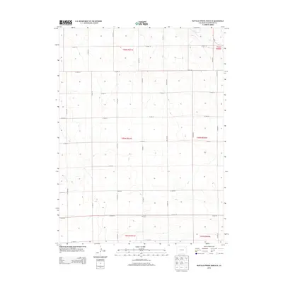
2013 Map of Buffalo Springs Ranch SE
USGS Topo · Published 2013About this map
Curtis Cem serves as a lone local landmark in this corner of Washington County, situated along the east-west corridor of Co Road 48. The landscape is defined by the high plains of eastern Colorado, where a rigid grid of section-line roads, including Co Road 55 and Co Road 54, facilitates agricultural access across the undulating terrain. In the northeast, the drainage of Rock Creek cuts across the grid, providing a rare natural break in the otherwise strictly surveyed township and range system. This 2013 survey illustrates a classic prairie settlement pattern, where infrastructure like Co Road HH and Co Road LL follows the cardinal directions, maintaining the organized footprint established by early homesteaders even into the modern era.
Find a feature on this map
25 named features on this map. Tap any name to fly to it.
Don’t see what you’re looking for? This feature index may not catch every label — zoom into the map to look around manually.
Map Details
Editions of this 2013 Buffalo Springs Ranch SE Map
This is the sole edition of this map. No revisions or reprints were ever made.
Other maps of this area

1954 · Sterling
USGS Topo · 1:250,000

1958 · Sterling
USGS Topo · 1:250,000

1972 · Glacken Hill
USGS Topo · 1:24,000

1972 · Otis
USGS Topo · 1:24,000

1972 · Burdett
USGS Topo · 1:24,000

1973 · Akron
USGS Topo · 1:24,000

1973 · Buffalo Springs Ranch NW
USGS Topo · 1:24,000

1973 · Platner
USGS Topo · 1:24,000

1973 · Buffalo Springs Ranch NE
USGS Topo · 1:24,000

1973 · Buffalo Springs Ranch SE
USGS Topo · 1:24,000