
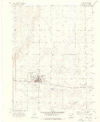
1973 Map of Akron
USGS Topo · Published 1976About this map
Akron serves as the focal point of this Eastern Colorado landscape, captured during a period of steady agricultural and industrial development in the early 1970s. The town grid is clearly defined, situated north of the Burlington Northern railroad line which historically drove the region's economy. Significant infrastructure is evident surrounding the settlement, including the County Fairground and County Airport to the west, while the Experimental Station (USDA) and Radio Facility lie to the east, indicating the area's role as a regional hub for research and communications.
Find a feature on this map
22 named features on this map. Tap any name to fly to it.
Don’t see what you’re looking for? This feature index may not catch every label — zoom into the map to look around manually.
Map Details
Editions of this 1973 Akron Map
2 editions found
Other maps of this area

1951 · Merino SE
USGS Topo · 1:24,000

1954 · Sterling
USGS Topo · 1:250,000

1958 · Sterling
USGS Topo · 1:250,000

1973 · Platner
USGS Topo · 1:24,000

1973 · Fremont Butte
USGS Topo · 1:24,000

1973 · Pinneo SE
USGS Topo · 1:24,000

1973 · Buffalo Springs Ranch SE
USGS Topo · 1:24,000

1973 · Akron SE
USGS Topo · 1:24,000
1973 · Buffalo Springs Ranch
USGS Topo · 1:24,000
1973 · Akron SW
USGS Topo · 1:24,000