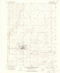
1973 Map of Akron
USGS Topo · Published 1976About this map
The town of Akron serves as the focal point of this 1970s survey, illustrating a well-organized prairie community defined by its transportation and agricultural infrastructure. The Burlington Northern railroad bisects the landscape, running parallel to the town's grid and supporting the local economy alongside the County Airport and the nearby Experimental Station (USDA). To the south of the main settlement, a Golf Course and Picnic Area reflect the community's established social spaces during this era.
Find a feature on this map
24 named features on this map. Tap any name to fly to it.
Don’t see what you’re looking for? This feature index may not catch every label — zoom into the map to look around manually.
Map Details
Editions of this 1973 Akron Map
2 editions found
Other maps of this area

1951 · Merino SE
USGS Topo · 1:24,000

1954 · Sterling
USGS Topo · 1:250,000

1958 · Sterling
USGS Topo · 1:250,000

1973 · Akron
USGS Topo · 1:24,000

1973 · Platner
USGS Topo · 1:24,000

1973 · Fremont Butte
USGS Topo · 1:24,000

1973 · Pinneo SE
USGS Topo · 1:24,000

1973 · Buffalo Springs Ranch SE
USGS Topo · 1:24,000

1973 · Akron SE
USGS Topo · 1:24,000
1973 · Buffalo Springs Ranch
USGS Topo · 1:24,000