
1973 Map of Pinneo SE
USGS Topo · Published 1976About this map
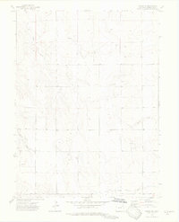
The Ranchero Oil Field and the North Rago Oil Field define the industrial footprint of this portion of Washington County during the early 1970s. The landscape is marked by numerous oil wells and drilling sites, reflecting the energy development occurring across the high plains. Natural drainage is shaped by ephemeral watercourses such as Camp Creek, Surveyor Creek, and Brunker Creek, which cut through the undulating terrain alongside Shears Draw. Local history interests are noted by the presence of a lone Grave and the site named Nancy, providing small but significant human markers in a region otherwise dominated by resource extraction. The southern portion of the sheet shows the Belle Oil Field extending toward the Base Line, where several Oil Wells and Oil Well 2 are clustered. This survey captures a specific moment when petroleum production was the primary driver of activity in this rural landscape.
Find a feature on this map
18 named features on this map. Tap any name to fly to it.
Don’t see what you’re looking for? This feature index may not catch every label — zoom into the map to look around manually.
Map Details
Editions of this 1973 Pinneo SE Map
3 editions found
Other maps of this area

1954 · Limon
USGS Topo · 1:250,000

1954 · Sterling
USGS Topo · 1:250,000

1957 · Limon
USGS Topo · 1:250,000

1958 · Limon
USGS Topo · 1:250,000

1958 · Sterling
USGS Topo · 1:250,000

1973 · Antelope Creek East
USGS Topo · 1:24,000

1973 · Akron
USGS Topo · 1:24,000

1973 · Antelope Creek West
USGS Topo · 1:24,000

1973 · Rago
USGS Topo · 1:24,000

1973 · Fremont Butte
USGS Topo · 1:24,000