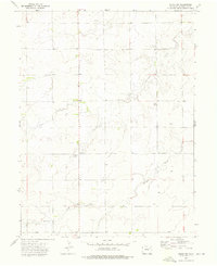
1973 Map of Akron SW
USGS Topo · Published 1976About this map
The rolling plains of Washington County appear here in the early 1970s, defined by the seasonal drainage patterns of Surveyor Creek and Brunker Creek. This semi-arid landscape is largely partitioned by the Base Line, showing a pattern of rural land use where isolated infrastructure supports the local population. A Community Center and a nearby Radio Facility serve as focal points for the surrounding agricultural community, while the presence of a Gas Well, several other wells, and Gravel Pits indicate the importance of resource extraction to the local economy. The area is marked by topographic markers like the Renkel name, providing a precise look at the terrain just south of Akron before modern developments altered the rural infrastructure.
Find a feature on this map
15 named features on this map. Tap any name to fly to it.
Don’t see what you’re looking for? This feature index may not catch every label — zoom into the map to look around manually.
Map Details
Editions of this 1973 Akron SW Map
This is the sole edition of this map. No revisions or reprints were ever made.
Other maps of this area

1954 · Limon
USGS Topo · 1:250,000

1954 · Sterling
USGS Topo · 1:250,000

1957 · Limon
USGS Topo · 1:250,000

1958 · Limon
USGS Topo · 1:250,000

1958 · Sterling
USGS Topo · 1:250,000

1973 · Antelope Creek East
USGS Topo · 1:24,000

1973 · Akron
USGS Topo · 1:24,000

1973 · Platner
USGS Topo · 1:24,000

1973 · Fremont Butte
USGS Topo · 1:24,000

1973 · Pinneo SE
USGS Topo · 1:24,000