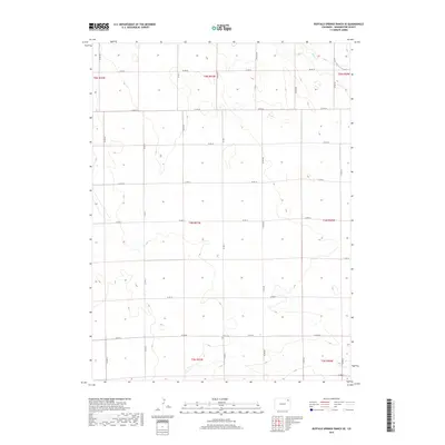
2019 Map of Buffalo Springs Ranch SE
USGS Topo · Published 2019About this map
Curtis Cem sits centrally in this section of Washington County, a quiet landmark within a landscape defined by the rigid grid of the Public Land Survey System. The terrain is structured by expansive township boundaries including t4n r51w and t5n r51w, where a network of gravel and dirt roads like Co Rd Jj and Co Rd Mm facilitate movement across the agricultural high plains. In the northeast corner, the drainage of Rock Cr introduces the only significant break in the geometric land patterns, carving a natural path through the surrounding range. This 2019 data reflects a region where traditional land use and family-named routes like Lockard Ln remain the primary features of the rural topography.
Find a feature on this map
27 named features on this map. Tap any name to fly to it.
Don’t see what you’re looking for? This feature index may not catch every label — zoom into the map to look around manually.
Map Details
Editions of this 2019 Buffalo Springs Ranch SE Map
This is the sole edition of this map. No revisions or reprints were ever made.
Other maps of this area

1954 · Sterling
USGS Topo · 1:250,000

1958 · Sterling
USGS Topo · 1:250,000

1972 · Glacken Hill
USGS Topo · 1:24,000

1972 · Otis
USGS Topo · 1:24,000

1972 · Burdett
USGS Topo · 1:24,000

1973 · Akron
USGS Topo · 1:24,000

1973 · Buffalo Springs Ranch NW
USGS Topo · 1:24,000

1973 · Platner
USGS Topo · 1:24,000

1973 · Buffalo Springs Ranch NE
USGS Topo · 1:24,000

1973 · Buffalo Springs Ranch SE
USGS Topo · 1:24,000