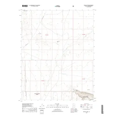
2018 Map of Buffalo Tanks
USGS Topo · Published 2018About this map
House Rock Valley dominates this high-desert landscape in Northern Arizona, where the remote northern reaches of Grand Canyon National Park meet the southeastern edge of the Kaibab National Forest. This modern 2018 survey reveals a terrain defined by dramatic drainage systems, including the deep incisions of Bedrock Canyon and Seegmiller Canyon that channel seasonal waters toward the Colorado River system. Human presence in this arid expanse is marked by essential livestock improvements and long-distance transit corridors. The namesake Buffalo Tanks provide a critical water source in an otherwise parched environment, while the Great Western Trail and Buffalo Ranch Rd serve as the primary arteries through the valley. To the south, topographic markers like Cane Cairn and the descent into South Canyon illustrate the transition from the relatively flat valley floor to the complex geology of the Grand Canyon rim.
Find a feature on this map
17 named features on this map. Tap any name to fly to it.
Don’t see what you’re looking for? This feature index may not catch every label — zoom into the map to look around manually.
Map Details
Editions of this 2018 Buffalo Tanks Map
This is the sole edition of this map. No revisions or reprints were ever made.
Other maps of this area

1886 · Echo Cliffs
USGS Topo · 1:250,000

1886 · Kaibab
USGS Topo · 1:250,000

1891 · Echo Cliffs
USGS Topo · 1:250,000

1936 · Jacobs Lake
USGS Topo · 1:48,000

1940 · Jacob Lake
USGS Topo · 1:62,500

1953 · Jacobs Lake
USGS Topo · 1:62,500

1953 · Grand Canyon
USGS Topo · 1:250,000

1954 · Emmett Wash NE
USGS Topo · 1:24,000

1954 · Emmett Wash NW
USGS Topo · 1:24,000

1954 · Nankoweap
USGS Topo · 1:62,500