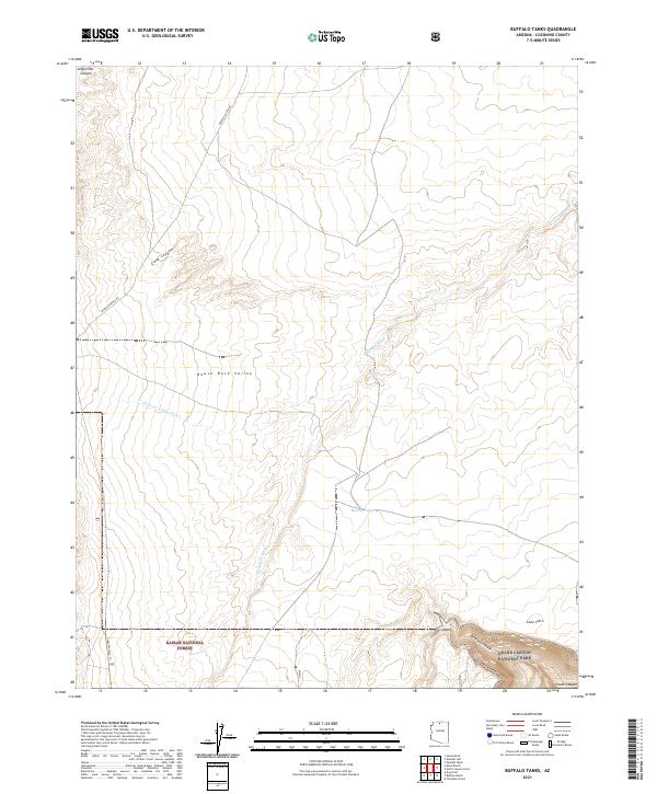
2021 Map of Buffalo Tanks
USGS Topo · Published 2021About this map
Grand Canyon National Park meets the southern boundary of the Kaibab National Forest in this high-desert landscape of Coconino County. The map is defined by the deep drainage systems of the House Rock Valley, where the N Canyon Wash and Pleasant Valley Outlet carry seasonal runoff across the arid terrain. The map provides a look at modern land management and recreation corridors, notably the Great Western Trl which traverses the western edge of the forest land.
Find a feature on this map
17 named features on this map. Tap any name to fly to it.
Don’t see what you’re looking for? This feature index may not catch every label — zoom into the map to look around manually.
Map Details
Editions of this 2021 Buffalo Tanks Map
This is the sole edition of this map. No revisions or reprints were ever made.
Other maps of this area

1886 · Echo Cliffs
USGS Topo · 1:250,000

1886 · Kaibab
USGS Topo · 1:250,000

1891 · Echo Cliffs
USGS Topo · 1:250,000

1936 · Jacobs Lake
USGS Topo · 1:48,000

1940 · Jacob Lake
USGS Topo · 1:62,500

1953 · Jacobs Lake
USGS Topo · 1:62,500

1953 · Grand Canyon
USGS Topo · 1:250,000

1954 · Emmett Wash NE
USGS Topo · 1:24,000

1954 · Emmett Wash NW
USGS Topo · 1:24,000

1954 · Nankoweap
USGS Topo · 1:62,500