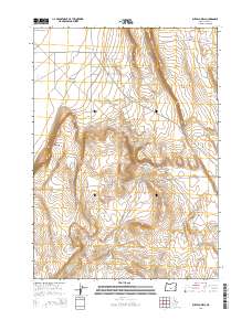
2014 Map of Buffalo Well
USGS Topo · Published 2014About this map
Buffalo Well stands at a central junction in this high desert landscape of Lake County, where early 21st-century infrastructure meets the ancient topography of the Great Basin. The terrain is defined by dramatic escarpments like Burma Rim and drainage patterns such as Rocky Draw and Hansen Valley. These natural features dictate the path of local routes, including the Christmas Valley Hwy and Burma Rd.
Find a feature on this map
20 named features on this map. Tap any name to fly to it.
Don’t see what you’re looking for? This feature index may not catch every label — zoom into the map to look around manually.
Map Details
Editions of this 2014 Buffalo Well Map
This is the sole edition of this map. No revisions or reprints were ever made.
Other maps of this area

1955 · Crescent
USGS Topo · 1:250,000

1957 · Crescent
USGS Topo · 1:250,000

1958 · Crescent
USGS Topo · 1:250,000

1970 · Crescent
USGS Topo · 1:250,000

1981 · Fossil Lake
USGS Topo · 1:24,000

1981 · Sand Rock
USGS Topo · 1:24,000

1981 · Elk Butte
USGS Topo · 1:24,000
1984 · Poverty Basin North
USGS Topo · 1:24,000

1984 · Horse Mtn
USGS Topo · 1:24,000
1985 · Fire Lake
USGS Topo · 1:24,000