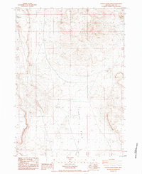
1984 Map of Poverty Basin North
USGS Topo · Published 1984About this map
Poverty Basin dominates the central landscape of this high desert terrain in Lake County, Oregon, revealing a region defined by its water management and distinct geological features. Surveyed through aerial photography from 1974 and 1980, the sheet documents an arid environment where ranching and resource extraction are supported by features like the Poverty Basin Well, a Water Tank, and the Diatomite Reservoir. The industrial history of the area is further suggested by a long Aqueduct cutting through the basin, likely supporting local mining or livestock operations. Topographical landmarks such as Saunders Rim, Horse Mtn, and the curiously named Doughnut Mtn provide significant elevation markers for researchers and surveyors. Remote water sources like North DC Waterhole highlight the isolation of this corner of the state during the early 1980s, offering a clear record of the infrastructure required to sustain activity in the Oregon backcountry.
Find a feature on this map
12 named features on this map. Tap any name to fly to it.
Don’t see what you’re looking for? This feature index may not catch every label — zoom into the map to look around manually.
Map Details
Editions of this 1984 Poverty Basin North Map
This is the sole edition of this map. No revisions or reprints were ever made.
Other maps of this area

1955 · Crescent
USGS Topo · 1:250,000

1955 · Klamath Falls
USGS Topo · 1:250,000

1957 · Crescent
USGS Topo · 1:250,000

1958 · Crescent
USGS Topo · 1:250,000

1958 · Klamath Falls
USGS Topo · 1:250,000

1970 · Crescent
USGS Topo · 1:250,000

1974 · Lake Abert
USGS Topo · 1:100,000
1984 · Alkali Buttes
USGS Topo · 1:24,000
1984 · Alkali Lake
USGS Topo · 1:24,000
1984 · Goodrich Well
USGS Topo · 1:24,000