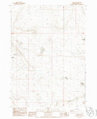
1985 Map of Fire Lake
USGS Topo · Published 1986About this map
High desert water management and remote livestock routes define this Lake County landscape as it was surveyed in the early 1980s. The map centers on Fire Lake (Corral), a location that suggests the intersection of vital water resources and ranching operations in a dry environment. The terrain is dominated by the dramatic ascent of Saunders Rim, which creates a natural barrier across the southern portion of the quadrangle. A network of unimproved roads and 4WD tracks, including the curiously named Burma Rd, connects various catchment points such as West Saunders Waterhole and South DC Waterhole. These features, along with small basins like Depaoli Lake and Packsaddle Lake, highlight the critical importance of reliable water sources for navigation and land use in this part of Oregon.
Find a feature on this map
11 named features on this map. Tap any name to fly to it.
Don’t see what you’re looking for? This feature index may not catch every label — zoom into the map to look around manually.
Map Details
Editions of this 1985 Fire Lake Map
This is the sole edition of this map. No revisions or reprints were ever made.
Other maps of this area

1955 · Crescent
USGS Topo · 1:250,000

1955 · Klamath Falls
USGS Topo · 1:250,000

1957 · Crescent
USGS Topo · 1:250,000

1958 · Crescent
USGS Topo · 1:250,000

1958 · Klamath Falls
USGS Topo · 1:250,000

1970 · Crescent
USGS Topo · 1:250,000

1974 · Lake Abert
USGS Topo · 1:100,000
1984 · Poverty Basin South
USGS Topo · 1:24,000
1984 · Poverty Basin North
USGS Topo · 1:24,000

1984 · Horse Mtn
USGS Topo · 1:24,000