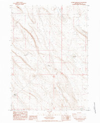
1984 Map of Poverty Basin South
USGS Topo · Published 1984About this map
Poverty Basin and the adjacent Alkali Valley define the arid landscape of this 1984 Lake County survey. The map details a sophisticated network of water management essential for survival in this high desert environment, where livestock and wildlife rely on scattered catchments. Among these are the Brattain Reservoir No 11 and Brattain Reservoir No 8, which, along with named water sources like Saunders Well, indicate the historical footprint of ranching operations. The topography is further punctuated by specialized sites like Poverty Corners Waterhole, Knob Waterhole, and Rim Waterhole, offering a precise record of the regional hydrology and land use before late-century shifts in range management.
Find a feature on this map
12 named features on this map. Tap any name to fly to it.
Don’t see what you’re looking for? This feature index may not catch every label — zoom into the map to look around manually.
Map Details
Editions of this 1984 Poverty Basin South Map
This is the sole edition of this map. No revisions or reprints were ever made.
Other maps of this area

1955 · Crescent
USGS Topo · 1:250,000

1955 · Klamath Falls
USGS Topo · 1:250,000

1957 · Crescent
USGS Topo · 1:250,000

1958 · Crescent
USGS Topo · 1:250,000

1958 · Klamath Falls
USGS Topo · 1:250,000

1970 · Crescent
USGS Topo · 1:250,000

1974 · Lake Abert
USGS Topo · 1:100,000
1984 · Coleman Hills
USGS Topo · 1:24,000
1984 · Alkali Buttes
USGS Topo · 1:24,000
1984 · Sawed Horn
USGS Topo · 1:24,000