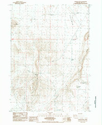
1984 Map of Coleman Hills
USGS Topo · Published 1984About this map
Coleman Hills dominate this high desert landscape of Lake County, Oregon, where the abrupt escarpment of Abert Rim defines the eastern boundary of the quadrangle. This 1984 survey reveals a region shaped by scarce water resources and cattle ranching, indicated by numerous named water points such as Euchre Butte Well, Leehmann Well, and Venator Butte Well. The terrain rises from the broad Coleman Flat in the north to the distinctive volcanic profiles of Jug Mountain and Flint Hills. Human presence is marked by subtle infrastructure including the Roadside Park along the highway and several Gravel Pits in the southern reach. The ephemeral nature of the high desert basin is visible at Soup Lakes and Gravelly Lake, which provide critical seasonal landmarks in an otherwise arid expanse of rangeland and rimrock.
Find a feature on this map
17 named features on this map. Tap any name to fly to it.
Don’t see what you’re looking for? This feature index may not catch every label — zoom into the map to look around manually.
Map Details
Editions of this 1984 Coleman Hills Map
This is the sole edition of this map. No revisions or reprints were ever made.
Other maps of this area

1955 · Klamath Falls
USGS Topo · 1:250,000

1955 · Adel
USGS Topo · 1:250,000

1957 · Adel
USGS Topo · 1:250,000

1958 · Klamath Falls
USGS Topo · 1:250,000

1958 · Adel
USGS Topo · 1:250,000

1962 · Adel
USGS Topo · 1:250,000

1966 · Rabbit Hills NW
USGS Topo · 1:24,000

1968 · Lake Abert North
USGS Topo · 1:24,000

1968 · Commodore Ridge
USGS Topo · 1:24,000

1974 · Lake Abert
USGS Topo · 1:100,000