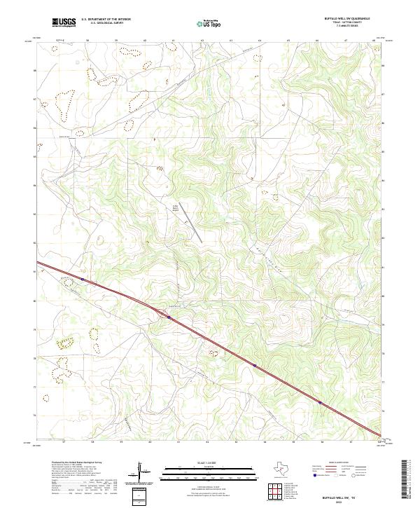
2022 Map of Buffalo Well SW
USGS Topo · Published 2022About this map
The N Llano River carves a winding path through this portion of the Edwards Plateau, shaping a landscape defined by deep drainage patterns like the North Llano Draw and Eightmile Draw. This 2022 survey captures a rural Texas ranching environment where modern infrastructure intersects with traditional land use. The presence of the JL Bar Ranch Airport suggests the contemporary scale of aviation-dependent ranching operations in this part of Sutton County.
Find a feature on this map
12 named features on this map. Tap any name to fly to it.
Don’t see what you’re looking for? This feature index may not catch every label — zoom into the map to look around manually.
Map Details
Editions of this 2022 Buffalo Well SW Map
This is the sole edition of this map. No revisions or reprints were ever made.
Other maps of this area

1893 · Rock Springs
USGS Topo · 1:125,000

1893 · Fort McKavett
USGS Topo · 1:125,000

1954 · Sonora
USGS Topo · 1:250,000

1958 · Sonora
USGS Topo · 1:250,000

1963 · Steen Lake
USGS Topo · 1:24,000

1963 · Buffalo Well
USGS Topo · 1:24,000

1963 · Live Oak Draw
USGS Topo · 1:24,000

1963 · Buffalo Well NW
USGS Topo · 1:24,000

1963 · Buffalo Well SE
USGS Topo · 1:24,000

1963 · Buffalo Well SW
USGS Topo · 1:24,000