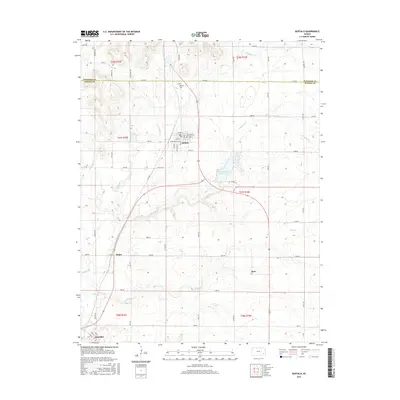
2015 Map of Buffalo
USGS Topo · Published 2015About this map
Buffalo serves as the primary population center in this northern section of Wilson County, situated just south of the Woodson Co line. The town's grid is clearly defined by local streets including Main St, Buffalo St, and Elm St, while the Buffalo Cem is located to the north. South of the main settlement, the rural landscape is dotted with smaller communities such as Roper, Rest, and Benedict, the latter situated near the southern edge of the survey area.
Find a feature on this map
58 named features on this map. Tap any name to fly to it.
Don’t see what you’re looking for? This feature index may not catch every label — zoom into the map to look around manually.
Map Details
Editions of this 2015 Buffalo Map
This is the sole edition of this map. No revisions or reprints were ever made.
Other maps of this area

1886 · Fredonia
USGS Topo · 1:125,000

1894 · Fredonia
USGS Topo · 1:125,000

1938 · Fredonia
USGS Topo · 1:62,500

1938 · Altoona
USGS Topo · 1:62,500

1939 · Altoona
USGS Topo · 1:48,000

1939 · Fredonia
USGS Topo · 1:48,000

1942 · Fredonia
USGS Topo · 1:62,500

1943 · Fredonia
USGS Topo · 1:62,500

1943 · Altoona
USGS Topo · 1:62,500

1947 · Joplin
USGS Topo · 1:250,000