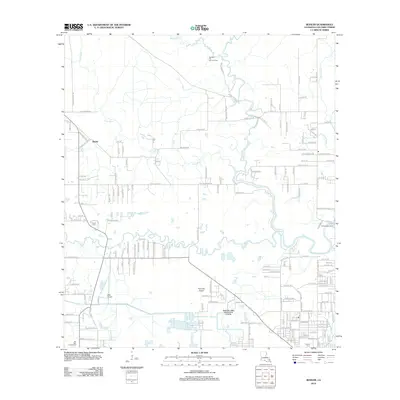
2012 Map of Buhler
USGS Topo · Published 2012About this map
The settlement of Buhler stands at the heart of this coastal Louisiana landscape, where the confluence of the Houston River and the W Fork Calcasieu River defines the drainage patterns north of Sulphur. In this era, the region balances industrial utility with rural homesteads, evidenced by the Beckwith Oil and Gas Field in the north and the Krause and Managan Canal cutting through the southern wetlands. Local history is anchored by the Royer Cem and Perkins Cem, while regional activity centers on the Cal-Cam Fairgrounds. The network of names like Stagecoach Ln and Buhler Station Rd hints at the transition from early transport routes to a landscape supporting aviation at KML Airport and Reynolds Airport.
Find a feature on this map
175 named features on this map. Tap any name to fly to it.
Don’t see what you’re looking for? This feature index may not catch every label — zoom into the map to look around manually.
Map Details
Editions of this 2012 Buhler Map
This is the sole edition of this map. No revisions or reprints were ever made.
Other maps of this area

1932 · Lake Charles NW
USGS Topo · 1:31,680

1935 · Buhler
USGS Topo · 1:31,680

1935 · Moss Bluff
USGS Topo · 1:31,680

1935 · Gordon
USGS Topo · 1:31,680

1935 · Gaytine
USGS Topo · 1:31,680

1942 · Lake Charles
USGS Topo · 1:62,500

1947 · Sulphur
USGS Topo · 1:31,680

1947 · Gaytine
USGS Topo · 1:31,680

1947 · Moss Bluff
USGS Topo · 1:31,680

1947 · DeQuincy
USGS Topo · 1:31,680