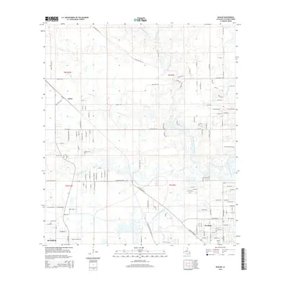
2015 Map of Buhler
USGS Topo · Published 2015About this map
The West Fork Calcasieu River and its many tributaries, including Little River, Beckwith Creek, and Indian Bayou, dominate this low-lying landscape north of the industrial corridor. The settlement of Buhler stands at a crossroads of Buhler Station Rd and Bankens Rd, while the southern portion of the map shows the suburban expansion of Sulphur and Westlake. This 2015 survey reveals how modern drainage and infrastructure, such as the Krause and Managan Canal and the KML Airport, have integrated with the natural wetlands of Bayou Verdine. Local history is preserved in sites like the Royer Cem and Perkins Cem, while the grid of roads such as High Hope Rd and W Houston River Rd illustrates the residential growth occurring between the river systems.
Find a feature on this map
135 named features on this map. Tap any name to fly to it.
Don’t see what you’re looking for? This feature index may not catch every label — zoom into the map to look around manually.
Map Details
Editions of this 2015 Buhler Map
This is the sole edition of this map. No revisions or reprints were ever made.
Other maps of this area

1932 · Lake Charles NW
USGS Topo · 1:31,680

1935 · Buhler
USGS Topo · 1:31,680

1935 · Moss Bluff
USGS Topo · 1:31,680

1935 · Gordon
USGS Topo · 1:31,680

1935 · Gaytine
USGS Topo · 1:31,680

1942 · Lake Charles
USGS Topo · 1:62,500

1947 · Sulphur
USGS Topo · 1:31,680

1947 · Gaytine
USGS Topo · 1:31,680

1947 · Moss Bluff
USGS Topo · 1:31,680

1947 · DeQuincy
USGS Topo · 1:31,680