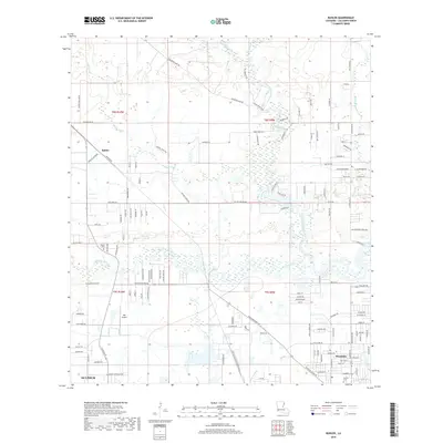
2018 Map of Buhler
USGS Topo · Published 2018About this map
West Fork Calcasieu River and the Houston River converge in this low-lying region north of Sulphur, where numerous creeks and bayous define the local geography. The settlement pattern is characterized by modern residential developments encroaching upon the riverine landscape, particularly near Westlake and the unincorporated community of Buhler. Transportation in the area relies on a dense network of local roads such as W Houston River Rd and Buhler Station Rd, reflecting the area's transition into a suburban landscape. For genealogists and local historians, the map identifies specific landmarks like Royer Cem and Perkins Cem, which provide ties to the early families of Calcasieu Parish. The presence of KML Airport and the pipelines like Perkins Pipeline Rd indicate the industrial and logistical infrastructure supporting the nearby urban centers.
Find a feature on this map
131 named features on this map. Tap any name to fly to it.
Don’t see what you’re looking for? This feature index may not catch every label — zoom into the map to look around manually.
Map Details
Editions of this 2018 Buhler Map
This is the sole edition of this map. No revisions or reprints were ever made.
Other maps of this area

1932 · Lake Charles NW
USGS Topo · 1:31,680

1935 · Buhler
USGS Topo · 1:31,680

1935 · Moss Bluff
USGS Topo · 1:31,680

1935 · Gordon
USGS Topo · 1:31,680

1935 · Gaytine
USGS Topo · 1:31,680

1942 · Lake Charles
USGS Topo · 1:62,500

1947 · Sulphur
USGS Topo · 1:31,680

1947 · Gaytine
USGS Topo · 1:31,680

1947 · Moss Bluff
USGS Topo · 1:31,680

1947 · DeQuincy
USGS Topo · 1:31,680