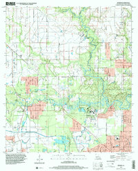
1998 Map of Buhler
USGS Topo · Published 2002About this map
The West Fork Calcasieu River winds through this landscape north of Westlake, where the riparian environment meets industrial and community development. This 1990s update, based on mid-century topography, reveals a geography defined by the confluence of the Houston River and various bayous. The settlement of Buhler occupies the northwestern portion of the map, while the eastern edge is anchored by the protected lands of Sam Houston Jones State Park. Local history is deeply embedded in the rural infrastructure, from the Indian Bayou Ferry to longstanding community markers like Mt Carmel Ch and Willow Spring Sch. The numerous burial grounds, including Lyle Cem and Royer Cem, reflect the generational settlement of Calcasieu Parish. The map also documents the industrial layer of the region, featuring a complex network of pipelines and the Krause and Managan Canal.
Find a feature on this map
28 named features on this map. Tap any name to fly to it.
Don’t see what you’re looking for? This feature index may not catch every label — zoom into the map to look around manually.
Map Details
Editions of this 1998 Buhler Map
This is the sole edition of this map. No revisions or reprints were ever made.
Other maps of this area

1932 · Lake Charles NW
USGS Topo · 1:31,680

1935 · Buhler
USGS Topo · 1:31,680

1935 · Moss Bluff
USGS Topo · 1:31,680

1935 · Gordon
USGS Topo · 1:31,680

1935 · Gaytine
USGS Topo · 1:31,680

1942 · Lake Charles
USGS Topo · 1:62,500

1947 · Sulphur
USGS Topo · 1:31,680

1947 · Gaytine
USGS Topo · 1:31,680

1947 · Moss Bluff
USGS Topo · 1:31,680

1947 · DeQuincy
USGS Topo · 1:31,680