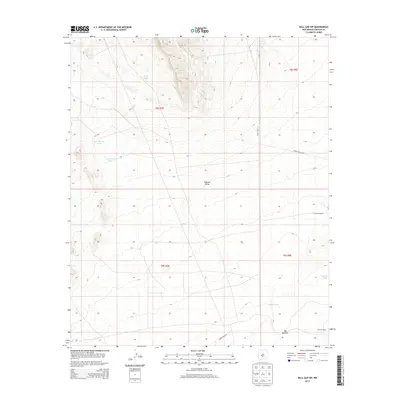
2013 Map of Bull Gap SW
USGS Topo · Published 2013About this map
Tularosa Valley defines this arid landscape in Lincoln County, where water management is the primary driver of human settlement and land use. The presence of specialized catchments like AAA Tank, Sam Dillard Tank, and J S Dillard Tank illustrates the effort to sustain livestock and life in this high-desert environment. Isolated homesteads such as Chihuahua Ranch and Withers Ranch stand as outposts within a terrain marked by deep seasonal drainage channels like Harkey Draw. In the southeastern portion of the map, The Malpais indicates a transition into geologically complex volcanic terrain. This survey reflects a sparsely populated area where large-scale ranching and military transit routes, including WSMR P Route 11, represent the contemporary footprint of the region.
Find a feature on this map
15 named features on this map. Tap any name to fly to it.
Don’t see what you’re looking for? This feature index may not catch every label — zoom into the map to look around manually.
Map Details
Editions of this 2013 Bull Gap SW Map
This is the sole edition of this map. No revisions or reprints were ever made.
Other maps of this area

1916 · Tularosa
USGS Topo · 1:125,000

1918 · Oscura Peak
USGS Topo · 1:125,000

1947 · Three Rivers
USGS Topo · 1:62,500

1947 · Capitol Peak
USGS Topo · 1:62,500

1948 · Chihuahua Ranch
USGS Topo · 1:62,500

1948 · Mockingbird Gap
USGS Topo · 1:62,500

1950 · Oscura
USGS Topo · 1:24,000

1954 · Tularosa
USGS Topo · 1:250,000

1958 · Tularosa
USGS Topo · 1:250,000
1981 · Bull Gap SW
USGS Topo · 1:24,000