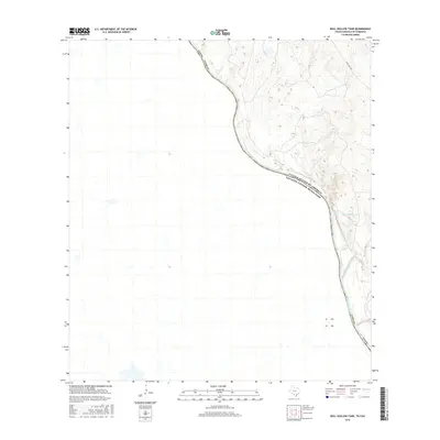
2016 Map of Bull Hollow Tank
USGS Topo · Published 2016About this map
The Rio Grande serves as the international boundary between Texas and Mexico in this 2016 survey, winding through a landscape shaped by seasonal watercourses and upland tanks. This specific reach of the border is defined by the sharp meanders of the river and the confluence of San Lorenzo Creek, which drains the arid terrain of Webb County. Historical movement through this region is traced via Eagle Pass Rd, a route that skirts the higher elevations to the east. Isolated water sources like Bull Hollow Tank are vital markers in this semi-arid environment, serving as focal points for local navigation and land management where permanent surface water is otherwise scarce beyond the riverbank.
Find a feature on this map
7 named features on this map. Tap any name to fly to it.
Don’t see what you’re looking for? This feature index may not catch every label — zoom into the map to look around manually.
Map Details
Editions of this 2016 Bull Hollow Tank Map
This is the sole edition of this map. No revisions or reprints were ever made.
Other maps of this area

1923 · Palafox
USGS Topo · 1:62,500

1929 · Cotulla
USGS Topo · 1:125,000

1940 · San Loranzo Creek
USGS Topo · 1:62,500

1940 · Chupadera
USGS Topo · 1:62,500

1953 · Crystal City
USGS Topo · 1:250,000

1955 · Crystal City
USGS Topo · 1:250,000

1956 · Laredo
USGS Topo · 1:250,000

1958 · Eagle Pass
USGS Topo · 1:250,000

1961 · Crystal City
USGS Topo · 1:250,000

1965 · Eagle Pass
USGS Topo · 1:250,000