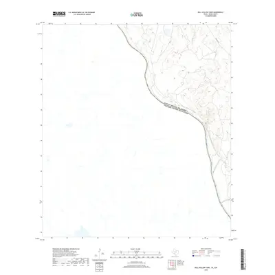
2019 Map of Bull Hollow Tank
USGS Topo · Published 2019About this map
Rio Grande waters define the international boundary between the United States and Mexico in this sparse borderland of Webb County. The rugged landscape is characterized by the confluence of San Lorenzo Creek and the major river, reflecting a remote section of the Texas frontier where few improved roads exist. Eagle Pass Rd provides the primary overland connection through the arid terrain, cutting across a geography defined more by its natural watercourses and topography than by dense settlement. This map documents the essential hydrology and simple transport infrastructure that sustains the ranching and border security operations of the modern era.
Find a feature on this map
4 named features on this map. Tap any name to fly to it.
Don’t see what you’re looking for? This feature index may not catch every label — zoom into the map to look around manually.
Map Details
Editions of this 2019 Bull Hollow Tank Map
This is the sole edition of this map. No revisions or reprints were ever made.
Other maps of this area

1923 · Palafox
USGS Topo · 1:62,500

1929 · Cotulla
USGS Topo · 1:125,000

1940 · San Loranzo Creek
USGS Topo · 1:62,500

1940 · Chupadera
USGS Topo · 1:62,500

1953 · Crystal City
USGS Topo · 1:250,000

1955 · Crystal City
USGS Topo · 1:250,000

1956 · Laredo
USGS Topo · 1:250,000

1958 · Eagle Pass
USGS Topo · 1:250,000

1961 · Crystal City
USGS Topo · 1:250,000

1965 · Eagle Pass
USGS Topo · 1:250,000