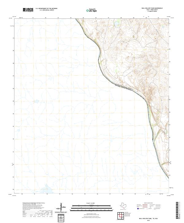
2022 Map of Bull Hollow Tank
USGS Topo · Published 2022About this map
The Rio Grande carves a sweeping path through this borderland reach of Webb County, marking the international boundary between the United States of America and Estados Unidos Mexicanos. The landscape is defined by the sharp contrast between the river's winding course and the arid drainage patterns of the high ground, where San Lorenzo Creek cuts toward the water. Human presence is sparse, dominated by the long stretch of Eagle Pass Rd navigating the terrain to the northeast. This 2022 survey captures the region's geographic isolation, showing a terrain largely undisturbed by modern development or dense settlement, where the hydrology of the river basin remains the primary feature of the landscape.
Find a feature on this map
4 named features on this map. Tap any name to fly to it.
Don’t see what you’re looking for? This feature index may not catch every label — zoom into the map to look around manually.
Map Details
Editions of this 2022 Bull Hollow Tank Map
This is the sole edition of this map. No revisions or reprints were ever made.
Other maps of this area

1923 · Palafox
USGS Topo · 1:62,500

1929 · Cotulla
USGS Topo · 1:125,000

1940 · San Loranzo Creek
USGS Topo · 1:62,500

1940 · Chupadera
USGS Topo · 1:62,500

1953 · Crystal City
USGS Topo · 1:250,000

1955 · Crystal City
USGS Topo · 1:250,000

1956 · Laredo
USGS Topo · 1:250,000

1958 · Eagle Pass
USGS Topo · 1:250,000

1961 · Crystal City
USGS Topo · 1:250,000

1965 · Eagle Pass
USGS Topo · 1:250,000