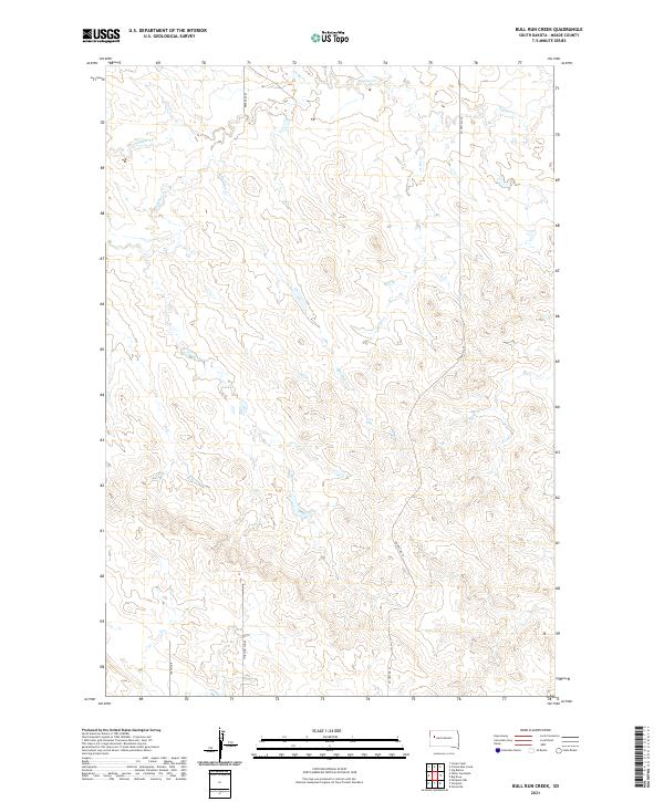
2021 Map of Bull Run Creek
USGS Topo · Published 2021About this map
Bull Run Cr and Sulphur Cr define the drainage patterns of this Meade County landscape, where the prairie is carved by a network of seasonal watercourses. The area is characterized by high-elevation divides separating the headwaters of Camp Cr and Cattle Cr, illustrating the hydrography typical of the western South Dakota plains. A sparse grid of local roads and section lines, including 160th Ave and Morning Sun Pl, provides access to these ranching lands within the Public Land Survey System townships of T9N, T10N, and T11N. Co Hwy Mc-23 serves as a primary north-south connector through the undulating terrain, tracing the subtle ridges between the creek beds.
Find a feature on this map
14 named features on this map. Tap any name to fly to it.
Don’t see what you’re looking for? This feature index may not catch every label — zoom into the map to look around manually.
Map Details
Editions of this 2021 Bull Run Creek Map
This is the sole edition of this map. No revisions or reprints were ever made.
Other maps of this area

1953 · Rapid City
USGS Topo · 1:250,000

1957 · Rapid City
USGS Topo · 1:250,000

1959 · Fairpoint
USGS Topo · 1:24,000

1959 · Stoneville
USGS Topo · 1:24,000

1959 · Fairpoint NW
USGS Topo · 1:24,000

1973 · Frozen Man Creek
USGS Topo · 1:24,000

1977 · Table Top Butte
USGS Topo · 1:24,000
1978 · Camp Creek
USGS Topo · 1:24,000

1978 · Bull Run Creek
USGS Topo · 1:24,000
1983 · Squaw Buttes
USGS Topo · 1:24,000