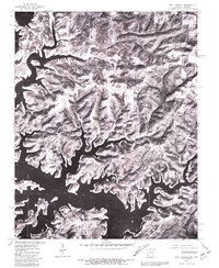
1979 Map of Bull Shoals
USGS Topo · Published 1981About this map
Bull Shoals Lake dominates this 1979 orthophotoquad, its complex, dendritic shoreline carving deeply into the Ozark Plateau of Marion County. The imagery captures the rugged topography of northern Arkansas and southern Missouri as it appeared following the creation of the reservoir, highlighting the intricate network of coves and ridges that define the regional landscape. On the southern banks, the organized street grid of Bull Shoals and the neighboring community of Lakeview illustrate the residential and commercial development that followed the dam's completion.
Find a feature on this map
6 named features on this map. Tap any name to fly to it.
Don’t see what you’re looking for? This feature index may not catch every label — zoom into the map to look around manually.
Map Details
Editions of this 1979 Bull Shoals Map
This is the sole edition of this map. No revisions or reprints were ever made.
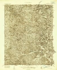
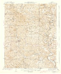
Other maps of this area

1890 · Mountain Home
USGS Topo · 1:125,000

1891 · Mountain Home
USGS Topo · 1:125,000

1893 · Yellville
USGS Topo · 1:125,000

1894 · Mountain Home
USGS Topo · 1:125,000

1903 · Yellville
USGS Topo · 1:125,000

1905 · Yellville
USGS Topo · 1:125,000

1929 · Yellville
USGS Topo · 1:125,000
1934 · Gainesville
USGS Topo · 1:48,000

1936 · Thornfield
USGS Topo · 1:48,000
1940 · Gainesville
USGS Topo · 1:62,500