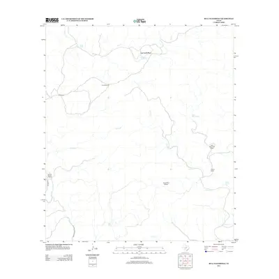
2013 Map of Bull Waterhole
USGS Topo · Published 2013About this map
Lost Creek Place occupies a landscape defined by intermittent water sources and ranching infrastructure in this part of Kinney County. The terrain is marked by seasonal drainages like Lost Creek and Live Oak Creek, where specific pooling points such as Wickham Waterhole and Bull Waterhole served as vital landmarks for land management. These water features are supplemented by groundwater sources including Riddle Spring, Moran Springs, and Boiling Springs, alongside mechanical improvements like the Stratler Windmill and Little Windmill. Transportation in this area relies on a modest network of local routes, specifically Tularosa Road and Farm-to-Market Road 3199, providing access to the Spring Ranch Airport in the western portion of the quadrangle.
Find a feature on this map
19 named features on this map. Tap any name to fly to it.
Don’t see what you’re looking for? This feature index may not catch every label — zoom into the map to look around manually.
Map Details
Editions of this 2013 Bull Waterhole Map
This is the sole edition of this map. No revisions or reprints were ever made.
Other maps of this area

1893 · Nueces
USGS Topo · 1:125,000

1896 · Nueces
USGS Topo · 1:125,000

1896 · Brackett
USGS Topo · 1:125,000

1897 · Brackett
USGS Topo · 1:125,000

1938 · Turkey Mountain
USGS Topo · 1:48,000

1943 · Turkey Mountain
USGS Topo · 1:62,500

1944 · Barksdale
USGS Topo · 1:62,500

1944 · Brackettville
USGS Topo · 1:62,500

1944 · Indian Mountain
USGS Topo · 1:62,500

1958 · Del Rio
USGS Topo · 1:250,000