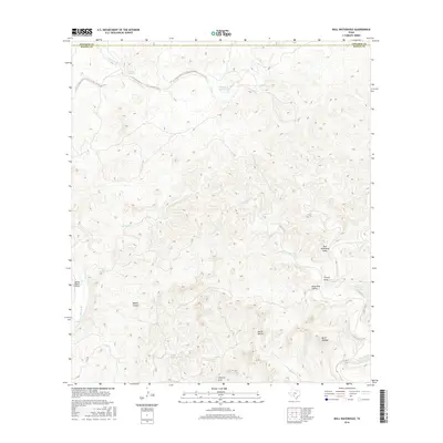
2016 Map of Bull Waterhole
USGS Topo · Published 2016About this map
Wickham Waterhole and the intricate drainage systems of Lost Creek and Sycamore Creek dominate this 2016 survey along the Edwards-Kinney County line. The landscape is defined by its hydrology and relief, with intermittent water sources like Riddle Spring and Boiling Springs serving as critical landmarks in an arid terrain. Higher elevations are marked by distinct peaks and ridges such as Mt El Shaddai and Loma la Cruz, while the canyons of Miguel Canyon and Smith Hollow carve through the limestone-heavy geography. Transport in this isolated portion of the Texas Hill Country is limited to the single corridor of FM 3199 and the private Spring Ranch Airport, illustrating the sparse, ranch-oriented settlement patterns that persist into the twenty-first century.
Find a feature on this map
21 named features on this map. Tap any name to fly to it.
Don’t see what you’re looking for? This feature index may not catch every label — zoom into the map to look around manually.
Map Details
Editions of this 2016 Bull Waterhole Map
This is the sole edition of this map. No revisions or reprints were ever made.
Other maps of this area

1893 · Nueces
USGS Topo · 1:125,000

1896 · Nueces
USGS Topo · 1:125,000

1896 · Brackett
USGS Topo · 1:125,000

1897 · Brackett
USGS Topo · 1:125,000

1938 · Turkey Mountain
USGS Topo · 1:48,000

1943 · Turkey Mountain
USGS Topo · 1:62,500

1944 · Barksdale
USGS Topo · 1:62,500

1944 · Brackettville
USGS Topo · 1:62,500

1944 · Indian Mountain
USGS Topo · 1:62,500

1958 · Del Rio
USGS Topo · 1:250,000