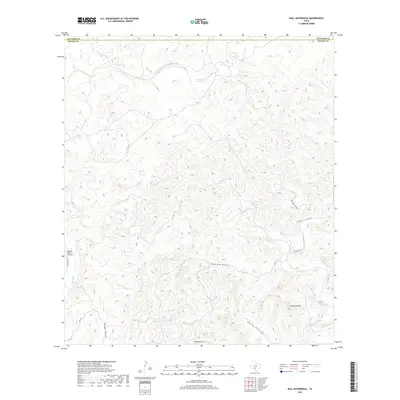
2019 Map of Bull Waterhole
USGS Topo · Published 2019About this map
The boundary between Edwards County and Kinney County cuts across a landscape defined by an intricate network of drainage draws and seasonal water sources in this part of southwest Texas. Remote ranching infrastructure is evident near the Spring Ranch Airport and along the few gravel corridors like Tularosa Rd. The geography is shaped by numerous named canyons and hollows, including Dead Pine Hollow, Miguel Canyon, and Smith Hollow, which funnel water toward larger drainages such as Sycamore Creek and Lost Creek. Rare reliable water points are marked by Wickham Waterhole and clusters of springs such as Moran Springs, Riddle Spring, and Boiling Springs. This rugged terrain culminates at landmarks like Loma la Cruz and the prominent Mt El Shaddai, providing essential navigational points for land management in this arid cattle-and-goat country.
Find a feature on this map
23 named features on this map. Tap any name to fly to it.
Don’t see what you’re looking for? This feature index may not catch every label — zoom into the map to look around manually.
Map Details
Editions of this 2019 Bull Waterhole Map
This is the sole edition of this map. No revisions or reprints were ever made.
Other maps of this area

1893 · Nueces
USGS Topo · 1:125,000

1896 · Nueces
USGS Topo · 1:125,000

1896 · Brackett
USGS Topo · 1:125,000

1897 · Brackett
USGS Topo · 1:125,000

1938 · Turkey Mountain
USGS Topo · 1:48,000

1943 · Turkey Mountain
USGS Topo · 1:62,500

1944 · Barksdale
USGS Topo · 1:62,500

1944 · Brackettville
USGS Topo · 1:62,500

1944 · Indian Mountain
USGS Topo · 1:62,500

1958 · Del Rio
USGS Topo · 1:250,000