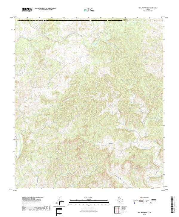
2022 Map of Bull Waterhole
USGS Topo · Published 2022About this map
The Edwards Co and Kinney Co border cuts through this landscape of drainage networks and isolated water sources in southwest Texas. The terrain is defined by complex arroyos and draws, most notably Bull Waterhole Draw and Cherry Draw, which channel seasonal runoff toward the primary watercourses of Sycamore Creek and Lost Creek. These intermittent streams are punctuated by vital permanent water points such as Wickham Waterhole, Riddle Spring, and Boiling Springs. The presence of Spring Ranch Airport in the western reaches indicates the scale of modern ranching operations, where air transport bridges the distance between remote homesteads. Notable topographic elevations like Mt El Shaddai overlook deep depressions including Dead Pine Hollow and Miguel Canyon, illustrating a dissected plateau where water remains the most significant geographic factor for navigation and settlement.
Find a feature on this map
21 named features on this map. Tap any name to fly to it.
Don’t see what you’re looking for? This feature index may not catch every label — zoom into the map to look around manually.
Map Details
Editions of this 2022 Bull Waterhole Map
This is the sole edition of this map. No revisions or reprints were ever made.
Other maps of this area

1893 · Nueces
USGS Topo · 1:125,000

1896 · Nueces
USGS Topo · 1:125,000

1896 · Brackett
USGS Topo · 1:125,000

1897 · Brackett
USGS Topo · 1:125,000

1938 · Turkey Mountain
USGS Topo · 1:48,000

1943 · Turkey Mountain
USGS Topo · 1:62,500

1944 · Barksdale
USGS Topo · 1:62,500

1944 · Brackettville
USGS Topo · 1:62,500

1944 · Indian Mountain
USGS Topo · 1:62,500

1958 · Del Rio
USGS Topo · 1:250,000