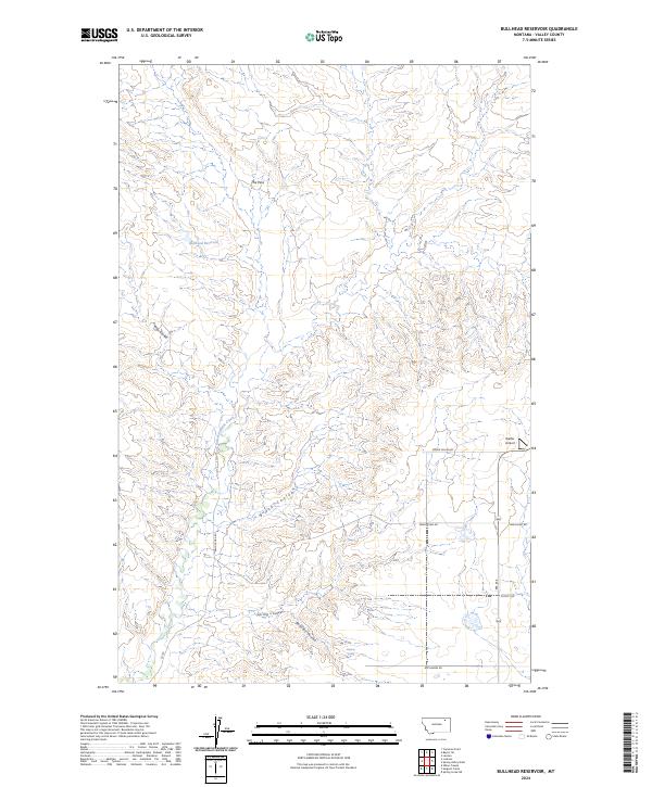
2024 Map of Bullhead Reservoir
USGS Topo · Published 2024About this map
Bullhead Reservoir sits at the heart of this landscape in Valley County, Montana, where a complex network of coulees defines the drainage of the region. The terrain is characterized by deep erosional features such as Hay Coulee, Black Coulee, and Bonnies Coulee, which channel seasonal water toward the East Fork Porcupine Creek. A prominent gap known as The Pass provides a natural corridor through the higher elevations in the northern portion of the quadrangle.
Find a feature on this map
21 named features on this map. Tap any name to fly to it.
Don’t see what you’re looking for? This feature index may not catch every label — zoom into the map to look around manually.
Map Details
Editions of this 2024 Bullhead Reservoir Map
This is the sole edition of this map. No revisions or reprints were ever made.
Other maps of this area

1915 · Spring Creek
USGS Topo · 1:62,500

1918 · Porcupine Valley
USGS Topo · 1:62,500

1954 · Glasgow
USGS Topo · 1:250,000

1957 · Glasgow
USGS Topo · 1:250,000

1958 · Glasgow
USGS Topo · 1:250,000

1973 · Baylor SE
USGS Topo · 1:24,000

1973 · Larslan
USGS Topo · 1:24,000

1973 · Cameron Point
USGS Topo · 1:24,000
1983 · Spring Creek SW
USGS Topo · 1:24,000
1983 · Bullhead Reservoir
USGS Topo · 1:24,000