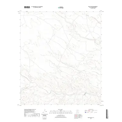
2019 Map of Bullis Gap NE
USGS Topo · Published 2019About this map
San Francisco Creek meanders through the southern reaches of this Brewster County landscape, following a winding path through the complex drainage systems of West Texas. The terrain is defined by a network of seasonal watercourses and prominent landforms, including the deeply etched Kellogg Canyon and Beef Canyon. These features demonstrate the erosive power of water in an arid environment, where drainage basins like those of Horse Creek and Cow Creek have carved distinct paths through the desert floor. The map captures a transition in topography as the relatively open northern sections near Maxon Cr and Brindle Canyon give way to the more fractured and intricate contours of the southern canyons. This 2019 survey provides an exacting look at the hydrological patterns that have historically dictated movement and land use in this isolated part of the state.
Find a feature on this map
8 named features on this map. Tap any name to fly to it.
Don’t see what you’re looking for? This feature index may not catch every label — zoom into the map to look around manually.
Map Details
Editions of this 2019 Bullis Gap NE Map
This is the sole edition of this map. No revisions or reprints were ever made.
Other maps of this area

1918 · Bullis Gap
USGS Topo · 1:62,500

1918 · Indian Wells
USGS Topo · 1:62,500

1920 · Longfellow
USGS Topo · 1:125,000

1928 · Sanderson
USGS Topo · 1:125,000

1954 · Fort Stockton
USGS Topo · 1:250,000

1958 · Fort Stockton
USGS Topo · 1:250,000

1959 · Emory Peak
USGS Topo · 1:250,000

1965 · Emory Peak
USGS Topo · 1:250,000

1968 · Big Brindle Canyon
USGS Topo · 1:24,000

1968 · Fresno Creek
USGS Topo · 1:24,000